TRAINS SEVERELY DISRUPTED AS HEAVY DOWNPOURS SPARK DELUGES IN BRITAIN
Britons faced major rail disruption due to severe flooding today after a person died in a mudslide amid a month's worth of rain and a Met Office 'danger to life' warning.
Avanti West Coast cancelled services between Preston and Scotland after the River Caldew burst its banks and flooded tracks at Carlisle, blocking the West Coast Main Line in both directions. Avanti urged passengers: 'Do not travel north of Preston.'
Other trains in the North of England were cancelled or delayed by speed restrictions due to the stormy weather, with Northern warning affected routes included York to Blackpool, Leeds to Manchester, Bradford to Huddersfield and Hull to Halifax.
The washout will continue today, especially in the North West which is under an amber warning. A further month's worth of rain is due in 24 hours between 12pm yesterday and 12pm today - after that same figure in the previous 24-hour period.
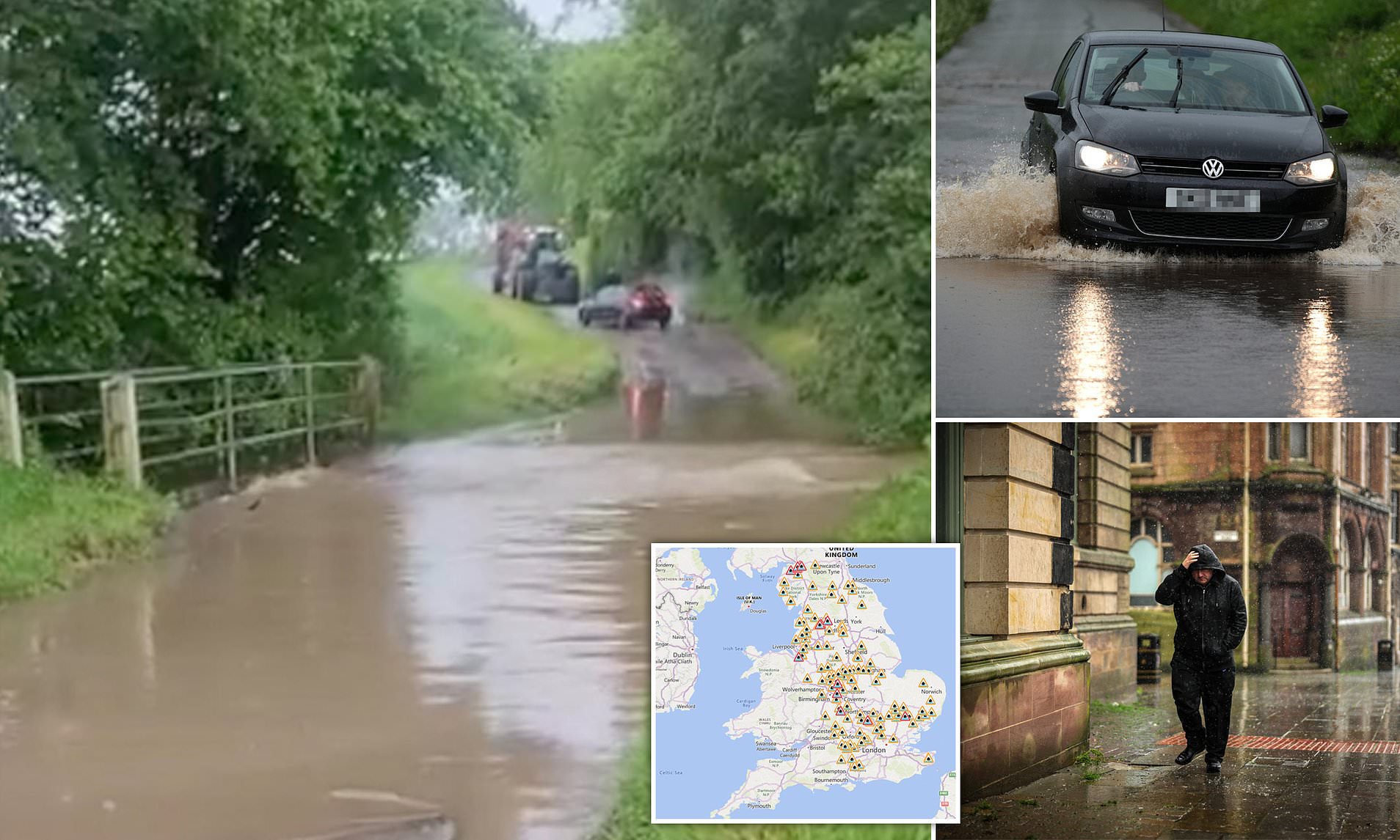
Downpours led to some homes being flooded, with properties in Cumbria and Essex evacuated - while sandbags were distributed in Harlow after drains overflowed. The Environment Agency imposed 20 flood warnings and 116 alerts for England today.
The wettest place yesterday was Toddington in Bedfordshire which saw 79mm (3.1in) of rain in 24 hours - compared to the UK's average rainfall for May of 71mm (2.8in).
As for the bank holiday weekend, Saturday will see dry conditions with temperatures of up to 21C (70F) in the South, but showers could return for Sunday and Monday.
It comes after North Yorkshire Police confirmed one person had died following a mudslide in the village of Carlton-in-Cleveland just after 1pm yesterday.
The Met Office said the area had seen almost a month's worth of rain in the past day, with 41.6mm (1.6in) recorded over the last 24 hours in Loftus, a town 20 miles away.
Simon Partridge, a forecaster at the Met Office, said: 'The average monthly rainfall for May in North Yorkshire is 57.5mm so they've almost had a month's worth of rainfall.'
Carlisle in Cumbria also experienced significant rainfall, with 65.6mm (2.6in) falling over the previous 24 hours.
The Environment Agency has issued a severe flood warning for the rivers Roe and Ive from Highbridge to Stockdalewath, south of Carlisle. The warning says flooding will be rapid due to rapidly rising water levels.
Cumbria Police said a number of properties have been affected in the Stockdalewath area, with one property evacuated.
Chief Superintendent Mick Bird said a multi-agency co-ordination group has been set up overnight to deal with localised flooding in the area.
'Emergency services have been responding throughout the night to calls for service following persistent rainfall, which has resulted in flooding in some parts of the county,' he said.
'The flooding is on a small scale and the public can be reassured that the weather forecast is expected to be much more favourable throughout today.
'We do expect some impact to travel within Cumbria with some flood water in parts of the county.'
A total of 20 flood warnings, where flooding is expected, have been issued across England with one in Scotland.
Mr Partridge said there was still 'quite a long way to go' until the rain was due to stop, with wet weather expected to continue in the area until this evening.
An amber warning for rain had been in place across parts of North Wales and North-West England, including Manchester and Liverpool, since midday yesterday.
A yellow warning for rain covered the North of England, the Midlands and North and central Wales until 6am today, while another was in place for southern and eastern Scotland until 6pm today.
Fast flowing or deep floodwater which may cause 'danger to life' was likely, the Met Office warned.
Heavy rainfall may also cause delays and cancellations to public transport services, difficult driving conditions and power cuts, the forecaster said.
Met Office chief meteorologist Neil Armstrong said: 'A band of prolonged and heavy rain will move north and west across the UK during Wednesday and Thursday.
'Areas exposed to the strengthening northerly winds are most likely to see the highest rainfall amounts, with a chance of some areas, particularly over higher ground in North Wales seeing more than 150mm, with parts of North West England seeing more than 80mm.
'Many places could see 30-40mm of rain, while a few areas may receive 60-80mm. Areas over higher ground in the Amber warning areas could see the equivalent of more than one months' worth of rain before the low pressure moves on, later on Thursday.'
Regarding staying safe in wet weather, Mr Partridge said: 'Although it may not look too bad when you leave home, it could turn much heavier once you're out and about, so the best thing is to plan your trips and if you don't need to go - the best advice is to try and avoid it.
'Keep an eye on your local warnings from the Environment Agency which are just as important as ours as well.'
He added that the forecast for the upcoming Bank Holiday weekend was looking 'uncertain' but the weather seemed to be 'getting better'.
Read more 2024-05-23T07:31:10Z dg43tfdfdgfd